Yesterday I posted on how weather models have been forecasting a bitter cold mid March for much of Europe.
This has now been confirmed by Joe Bastardi at his latest Saturday Summary here beginning at about 3 minutes into the report.
Not only does the GFS show bitter cold for mid March taking hold across Europe but so does the European model. Joe states at 3:22:
Europe has been very cold the past several days and will continue to be cold. It’ll warm up and then turn very very cold there again.”
Powerful La Niña in the pipeline
But what was more interesting in yesterday’s Saturday Summary was the Scripps forecast for the El Niño Southern Oscillation (ENSO), which currently projects a La Niña with a value of -2.64 to be reached by the end of the year, see 18:00 mark.
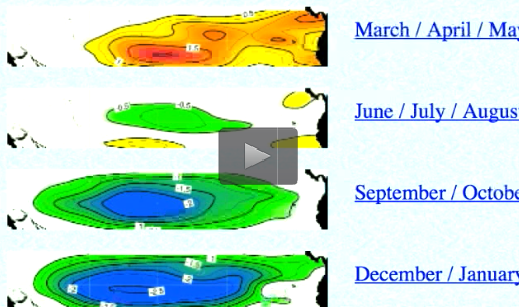
By December/January 2016/17, a powerful La Niña is forecast to disrupt global weather, usher a major cooling. Source: WeatherBell Saturday Summary
A value of -2.64 is pretty intense. Though Joe does not think the La Niña will get that extreme when all is said and done, it’s clear that a significant event is very likely looming. Joe says Scripps is forecasting a stronger La Niña then what the El Niño was.
I wonder if we are going to be hearing about that from the alarmist side.
The veteran Weatherbell Analytics meteorologist points out that over the past decade the global equatorial Pacific sea surface temperature has been on the cool side more often – a fact that bodes ill for those with bets placed on continued alarming global warming. Expect more data fudging alterations ahead.
Add to this intense La Niña the cooling North Atlantic and solar activity that is tapering off, and all the ingredients are there for inconvenient cooling over the next years.


That perceived cooling will be due to natural variation masking the increasing heat being trapped by Anthropogenic Greenhouse Gases in acidifying oceans. It’s really much worse than they thought – Betcha.
We just got 1 inch of rain in 10 hours.
Yearly average is 9 inches.
Some local flooding.
Better than freezing, I think.
I am not looking forward to major cooling.
Thanks Pierre.
Why do we not focus on the current extreme warm, even in the UAH data?
http://www.drroyspencer.com/2016/03/uah-v6-global-temperature-update-for-feb-2016-0-83-deg-c-new-record/
Why would the most important topic again be a forecast, that might happen or might not?
We know that the satellite data is trailing behind surface data. so we will see some more warm, before it might even get cold.
“Why do we not focus on the current extreme warm, even in the UAH data?”
What? Now you’re a fan of satellite data? How times change.
Anyway. I’ll keep you informed about whether Munich gets shockfrosted. They don’t have a lot of wind here, I’ll easily manage -40 deg C.
“What? Now you’re a fan of satellite data? How times change.”
No, i am not. The satelllite data has a huge problem: El nino is causing huge swings to short trends, and we have only a little amount of data.
The only place it was “extremely warm” in January and February was in the west European and Eastern Russian WINTER.
And I bet they were HIGHLY GLAD of that extra couple of degrees.
That should be western Russia.!
Hey sob.. have you ever heard of an “El Nino” ?
Now start to prepare for its little sibling.. La Nina.
Buy blankets. !!
Hey, that’s weird, the start quotes “are come up at the bottom of the line” !!
Sí,
Pero ¿dónde está el “enfriamiento?”
Welcome back, sod. We’ve missed your comic relief, here (although I’ve managed to maintain my amusement by viewing your speculations getting shot down on Euan Mearns site, Energy Matters).
As to why we aren’t focusing on “the current extreme warm”, have you looked at how the temperature peaks at the end of an El Nino event? What we’re seeing is normal
http://www.cpc.ncep.noaa.gov/products/analysis_monitoring/enso_advisory/ensodisc.html
Agreed, and if it weren’t for his perenially cheery disposition, he’d be downright annoying.
“Expect more data fudging alterations ahead.” – Pierre
I wonder just how much further they think they can go with this?
http://www.c3headlines.com/2016/03/rss-scientists-science-study-reveals-large-global-warming-temperature-fabrication-by-cherry-pick.html
Whatever you do, guys, DON’T look down!
Cold isn’t all these people are missing.
http://www.powerlineblog.com/archives/2016/03/academic-gibberish-watch-we-have-another-winner.php
That warm troposphere was actually all that lovely warm air coming up North from tropics due to the change in the Jet Stream and then vanishing in to space. The satellites measured it on it’s way out.
Thus it is an indication of Global Cooling.