According to global warming catastrophists, climate change is good for everything that’s bad, and bad for all that is good.
So not surprisingly, many have been claiming for years that tornadoes will become ever stronger, more frequent and so devastating that we’ll be sorry for not listening. But as many of us are finding out, their claims are a real load of bullcrap. Everyone knows there are loads of other major factors at work. and they cannot be possibly ignored.
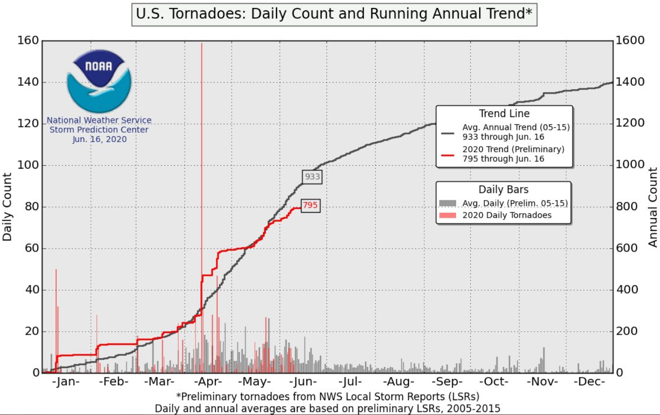
Tornado activity well below normal
40-year veteran meteorologist Joe Bastardi tweeted yesterday that tornado activity would be at a record low level right now had it not been for one single day of intense activity last April:
https://twitter.com/BigJoeBastardi/status/1273584554050273283
Naturally one season says nothing about the overall trend. Luckily we have annual data on tornado activity going back decades. Again some would have us believe that the trend is upward, meaning more tornadoes each and every year.
But the data tells us a different story:
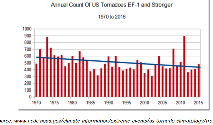
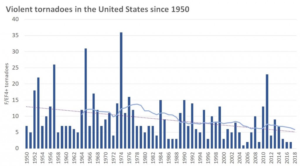
In summary, when it comes to tornadoes in the US, if anything, the warming has had a diminishing effect on activity, and that’s good news.
Like Joe Bastardi says, “Remember that when the climate change hype with hurricanes starts.”
Speaking of this year’s hurricane season, many serious experts are warning that a stronger than normal season likely awaits us…due to natural oceanic cyclic patterns. The alarmists on the other hand of course will blame it on CO2.
Sahara dust to hamper Atlantic tropical storm formation
But one meteorologist says that currently there’s one factor acting to suppress tropical storm formation: Sahara dust.
Paul Dorian of Perspecta Weather reports:
Sahara Desert dust is pushing across the Atlantic and it should reach all the way into the southern US…an inhibiting factor for tropical activity…possible brilliant sunsets.*
That would be great news for people living along the US coast, but more bad news for the alarmists.


Man made CO2 causes climate scientists to make bad predictions.
The animation forecast is interesting.
We live in Washington State, so the initial flows will not reach us.
The particles will get into the Westerlies and — perhaps — reach us in a week or so.
Link to the U.S.’s National Hurricane Center: https://www.nhc.noaa.gov/
This brings up a map (can switch to the Pacific) of the Atlantic Ocean and has options to look at the season as it develops, or not.
We have a very active season forecasted ( have had it since March 10) African dust is likely to diminish due to the Azores Bermuda high configuring itself 5 degrees further north, It may mean later developing waves, but the current closest SST analog ( see our Saturday Summary) is 2005. The MJO is in th telltale phases for an active season, but June is not the month for African waves to develop. If one does it usually means a hyperactive season