By Die kalte Sonne.
(Translated/edited by P. Gosselin)
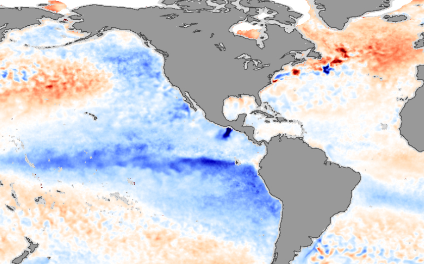
2007 La Nina. Symbol image, from NASA.
When it comes to German TV meteorologists, warm and dry weather is no longer good weather, but bad weather. At least that’s what often we read. Australia has at present very beautiful weather by this logic. ABC reports about an unusually cold season down under.
“The exceptionally cloudy conditions this spring kept maximum temperatures well down on recent years.
Melbourne, Adelaide and Canberra all shivered through maximums at least one degree below average and the lowest since 1992. Brisbane’s spring was the coldest in 12 years, and for Perth it was the coldest in six.
Sydney’s maximums were the lowest in four years but the mean temperatures, which includes the minimums, was the coldest since 2003 and the city failed to reach 30C for the first time in three decades.
Hobart was colder in 2021 and Darwin does not have a spring.
Even more unusual is some western suburbs of Sydney, including Penrith, failed to hit 30 degrees for the first time on record.
This spring was only the second time in a decade the mean maximum averaged across Australia was below the long-term average.
Of the 42 seasons since winter 2012, the only other season with colder than normal days was summer 2020-2021.”
The article does not name a changing climate as the cause, also known as climate heating because with such cooling, that would be a bit difficult, although it is also often argued that it is getting colder because it is getting warmer. It is the La Niña situation that is bringing Australia the humidity but also the cold. In 2010 there were also such temperatures and also then there was a strong La Niña.
What is unusual this time is that it is already the third La Niña in a row.
“In many ways this spring just followed the script and had no chance of being the often romanticised warm and sunny version depicted in fairy tales.
Throughout the past 20 years only one other spring has been colder than normal for maximums, and that was 2010 — also a year with a strong negative Indian Ocean Dipole and La Niña.
What was a surprise though was the abnormally cold November which eventuated after numerous pulses of polar air escaped from Antarctica and took a vacation on our shores.
The result was rare late spring snow as far north as Central West NSW and the coldest November on record for some towns, including Forbes and Ivanhoe, where maximums were more than five below average.”
We remind you once again that the U.S. Weather Bureau always makes its forecast regarding El Niño and La Niña only for a period of about 6 months. There is a reason for this: longer-term forecasts, such as those made by PIK in 2019, turn out to be wrong. Instead of an El Niño, a La Niña came. One has heard little about further forecast attempts since this misprediction. We reported on the failure at the time. Reliable forecasts would undoubtedly be important in order to be able to adjust to the conditions, but perhaps “science is settled” is not yet the last word in wisdom. Or to put it philosophically in the style of Plato: We know that we know nothing. The World Meteorological Organization cautiously assumes that we can expect La Niña conditions for the next few months.
- “”The tropical Pacific has been in a La Niña state since September 2020 with a short break in June-August 2021; this La Niña situation is still continuing as of mid-November 2022, with La Niña event thresholds exceeded for both oceanic as well as atmospheric conditions.
- Model predictions and expert assessment indicate that La Niña is very likely to continue, with about a 75% probability, during December-February 2022/2023. The chance of ENSO-neutral is about 25% and for El Niño is near-zero. For January-March 2023, the probability for La Niña decreases to about 60%.
- Transition of the current La Niña to ENSO-neutral is favored during February-April 2023, with about a 55% chance of ENSO-neutral conditions in this period, increasing to about 70% during March-May.
- The chance of El Niño developing is negligible until later in boreal spring, increasing to around 25% during May-July 2023.”


I thought I should get in early and point out that three La Niña events in a row in Australia are rare, but not “unprecedented”. Triple La Niñas have occurred in 1973–1976 and 1998–2001.
The first set caused large floods but nowhere near as much as in 1956. The current ‘triple’ seems to be causing equally wide spread heavy rain, but there is a query about the effect of the Hunga Tonga-Hunga Ha’apai volcano erruption in January this year. The past winter wasn’t that cold, just overcast and wet.
In any case the locals are fed up with the weather, the continuing failure of the BOM to make accurate predictions (even just a day ahead) and the hysterical screams of the dwindling numbers of believers in AGW that it is all due to climate change.
It really is a tough time for the alarmist cabal here in the US. Greenland SMB growing. Super cold Artic air descending or about to descend well down into the temperate zones in the NH and “Green Energy” is failing to produce in Europe as the cold is poised to hit. Fuel oil being rationed in New England. Globally Tropical Storms only 74% of the 30 year mean and the Atlantic Hurricane season not only failed to even come close to the hype but turned out to be below average. Tornado incidence only around the 20th percentile of the average.
And so the “news” must spend endless words on denying that Twitter Gate is a “bomb shell” and other such stuff.
ENSO is a weather event that is as yet not fully understood and not predictable. But…when there is an El Nino event that causes a lot of warm weather the usual suspects lie by omission in avoiding any mention of it in their reports claiming it is climate change.
In a normal world the media would be all over the involvement of the FBI in corrupting US elections other than they were doing the same thing. However, now we have the internet so that the legacy media can be sidelined and curious people can inform themselves.
The polar vortex in the lower stratosphere is broken into two parts according to the geomagnetic field in high latitudes. One part will swirl over northern Canada, bringing heavy frost to the northern US. The other vortex will spin over Siberia and bring Arctic air to Europe.
https://i.ibb.co/rcccDSk/gfs-z100-nh-f00.png
https://www.geomag.nrcan.gc.ca/images/field/fnor.gif
https://i.ibb.co/YTXJvNs/Zrzut-ekranu-2022-12-07-112657.png
It was 17 below zero this morning, 26 below zero 30 miles north, 50 miles further east, it was 36 below zero, the elevation at 2600 feet was probably 40 below.
No controlling cold weather, just happens to happen. When it’s winter, insouciant Old Man Winter does his job.
Think of the oceans as a giant can of soda, holds lots of carbon dioxide, has to, ocean marine life needs it just as bad as anywhere else on the planet. Think of the poor kelp, ocean forests, they have to have carbon dioxide.
Too much can be bad, Lake Nyos is the prime example. Displaces all of the air, all carbon dioxide, people and animals don’t survive.
The lake is now controlled by circulation of the water.
[…] From the NoTricksZone […]
[…] From the NoTricksZone […]
It’s all because of Man-Made Global War.. I mean, Climate Change. You can be sure of that. The BOM will tell us so.
Right now in Brisbane we are suffering what is being called “extreme heat”.
That is, 30 degrees. Which is actually normal for summer in Brisbane.