Coastal history analyses increasingly suggest sea levels are lower today than at any time in the last 7000 years – even lower than the 1600s to 1800s.
Recently we compared cartology from the 17th to 19th centuries to direct aerial images of coastal positions today. Rather surprisingly, there seemed to be more land area below sea level a few hundred years ago.
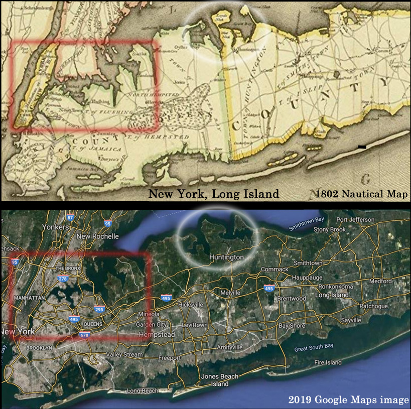
For example, an 1802 nautical map of New York City and Long Island shows there may have been more open waters in this region during the Little Ice Age than in 2019.

Image Source: Amazon.com
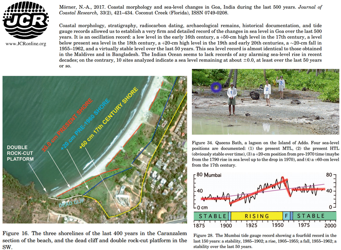
Shoreline analysis from India also suggests the coasts were further inland during the 1600s than they are today (Mörner, 2017).

Image Source: Mörner, 2017
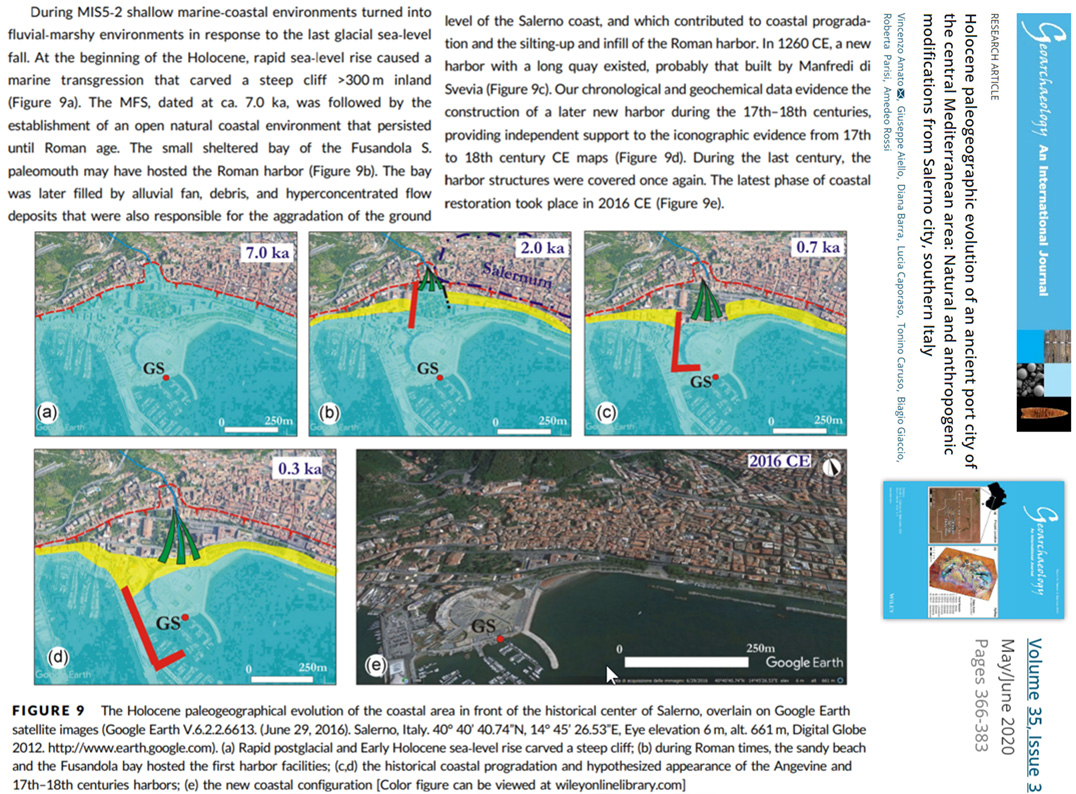
In another new study, the borehole sea level history for the Italian port city of Salerno reveals the coast was hundreds of meters further inland compared to today’s 7000 years ago. Even 300 years ago the coast was still much further inland (Amato et al., 2020).

Image Source: Amato et al., 2020
Citing previous studies, another new paper has today’s sea levels about 2 to 3 meters lower than they were 4000 to 5000 years ago along the coasts of Brazil (Martins et al., 2020). And, again, today’s relative sea levels seem to be the lowest of the record – lower than the Little Ice Age.


Out of curiosity, do these comparisons account for the artificial buildup of land over time, such as was done with Manhattan Island (https://gizmodo.com/watch-new-york-city-s-boundaries-expand-over-250-years-496440467) and, presumably, elsewhere in the NYC area?
Lands even continents tilt.Some because of release from the ice sheets which depressed them. Still doing it See a geomorphology text book.
Some land masses are affected by tectonic plates dipping or overriding other plates
see geology text books
Yes, and since the land masses have larger coastlines today than they did in the 1980s (i.e., the “coasts are growing all over the world“), we probably shouldn’t be too concerned that we’re living in scary times with regard to sea level changes.
Man made CO2 causes falling sea levels.
If it can make so that «Britain’s climate is becoming very hot, very cold, very wet and very dry. All at the same time» (see the link) — what this magic substance cannot do?! :]
In Mary Beard’s (UK TV historian) documentary about Pompeii she showed where the boats used to be tied up on the city walls.
These city walls are now (AUIUI) hundreds of meters from the water’s edge.
Or even metres.
Wasn’t there a vast inland sea about the same time frame and would explain the lower sea levels?
Lake Chad as large as the Caspian Sea.
Linked: the graph of Caspian Sea level variations, according to Khazarian expedition of1959-1963, from -III to XX century. Cyclons go South – Middle – South – Middle – North – South – Middle – North – North – North.
So the maximum was in XIV century. For last 250 years or so, it’s going down (which is not pretty), though it’s still not nearly as low as it was 1500 years ago.
How depth of Lake Chad changes depends on weather patterns over there, of course.
But compared to the oceans, they both put together are small, anyway.
[…] Scores Met welke medicijnen mag je niet in de zon? Misleading HEPA-Filter Efficiency Claims? New Studies Suggests Sea Levels Are Lower Today Than They Were Even During The Little Ice Age Quebec women should be reimbursed for implant removal in U.S., report says Scientists unlock […]