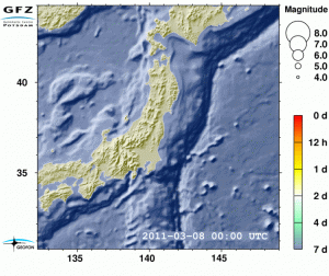
The animated graphic below was created by geophysicist Joachim Saul from the Helmholtz Association GFZ Research Centre for Geosciences, read here and shows the sequence of quakes since March 9. The animated image is available at www.gfz-potsdam.de. Click the image to activate.
The GFZ press release writes:
It shows the earthquake activity in the region of Honshu, Japan, measured at the GFZ since 8 March 2011. After a seismically quiet 8th March, the morning (coordinated universal time UTC) of the March 9 began with an earthquake of magnitude 7.2 off the Japanese east coast, followed by a series of smaller aftershocks.
The morning of March 11 sees the earthquake disaster that triggered the devastating tsunami. This earthquake is followed by many almost severe aftershocks, two of which almost reach the magnitude 8. In the following time period the activity slowly subsides, and is dominated today (March 16) by relatively small magnitude 5 quakes, though several earthquakes of magnitude 6 are being registered on a daily basis.
By analysing over 500 GPS stations, the GFZ scientists Rongjiang Wang and Thomas Walter have found that horizontal displacements of up to five meters in an eastern direction occurred at the east coast of Japan. The cause lies in the earthquake zone, i.e. at the contact interface of the Pacific plate with Japan. Computer simulations of this surface show that an offset of up to 25 meters occurred during the earthquake.
Calculations of the GFZ modeling group headed by Stephan Sobolev even yielded a displacement of up to 27 meters and a vertical movement of seven meters. This caused an abrupt elevation in the deep sea, and thus triggered the tsunami. The images of the GPS displacement vectors and the computer simulations can also be found among the online material provided by the GFZ.
Already shortly after the quake Andrey Babeyko and Stephan Sobolev of the GFZ modeled the propagation and wave heights of the tsunami in the Pacific over the first 16 hours. The tremendous force of the earthquake is highlighted here, too: in the open Pacific, relatively large wave heights of over one meter were calculated, which agrees very well with the observations. How high the tsunami is piled up on the coast is largely determined by water depth and the shape of the coastline. The GFZ material also contains an image and an animation regarding this work.”


Just about 10 minutes ago or less, another earthquake here in Manila. I noted how long it was, about 20 seconds, and I’m on the 25th floor of a building. Maybe it was just 15 seconds and the other 5 seconds was the building’s swaying.
Whenever I hear alarmist stories about earthquakes and volcanic eruptions, I tell people that we should be thankful of those geological movements. No volcanic eruptions, no Philippines and other islands and countries. Our country rose from under the sea because of volcanic activities millions of years ago.
Thanks for the news flash. We hope everything is okay for you and not too much damage. Sounds like it wasn’t exactly a small one.
Pierre, we have about 4 earthquakes a day on average in the Philippines alone, both on land and on the sea, but most of them are weak and are noted only by seismographs. Last Monday, March 21, there were 5 earthquakes in 5 different locations, the strongest was the one I felt, magnitude 5.7 in an island south of Manila. It was probably magnitude 4 here. No damages, and people here are generally used to feeling mild earthquakes from time to time.