The Arctic had a steep last spurt of melt over the last week, sending the ice area below 5 million sq. km. That puts 2010 as the third lowest ice extent, or the 2nd highest in the last four years, spin it the way you want.
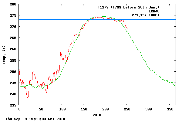
But the melt is now pretty much over, and temperatures in the Arctic have started their plunge. The Danish Meteorological Institute’s latest graphic clearly shows.
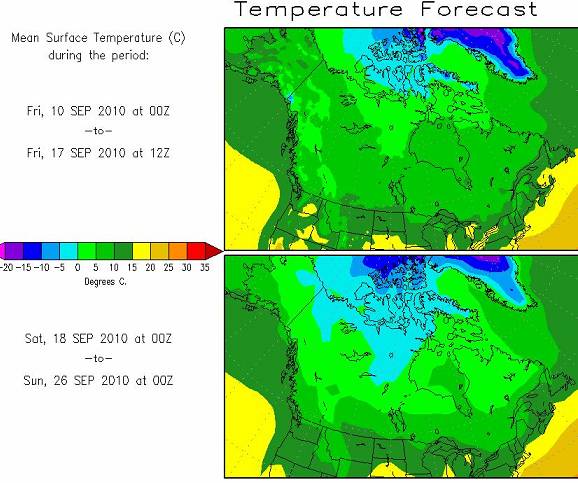
The Arctic forecast for the next 14 days shows things are going to get cold fast, with frost spreading south into Canada.
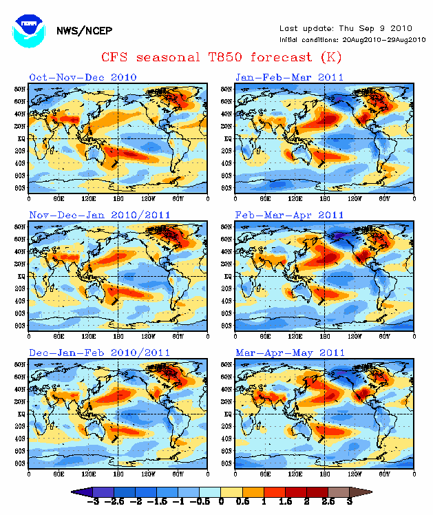
Colder than normal Arctic is in the forecast for the coming winter
But this happens every year of course. Unless winds play some tricks, the sea ice area is not going to get less. The volume reduction is over. So what can we expect for the coming winter? Joe Bastardi for example predicted we would finish at about where we finished this years, but then predicted a recovery over the next couple of years. We’re entering a cold PDO, and the NOAA forecast for the coming winter indicates a colder than normal Arctic.
Remember, NOAA and GISS are used to painting the Arctic red, and not blue. So, if the foreacst pans out, both poles will be colder than normal. That means thicker and more extensive ice. That’s why I made the WAG prediction a couple weeks ago of 5.75 million sq km for September, 2011. Maybe it’s a bit on the high side, but more likely than the once almost certain death spiral made by the experts a couple of years ago.




Pierre, thanks for this posting.
Studying the past ice extend fluctuations that have happened during the current Interglacial, I think we have to skip remarks like ‘RECOVERY”.
EVERYTHING THAT TAKES PLACE AT THE ARCTIC AND ANTARCTIC IS WELL WITHIN THE LIMITS OF THE ULTIMATE EXTREMES THAT HAVE HAPPENED IN THE PAST:
– GLOBAL GLACIATION
– TOTAL DISAPPEARANCE OF POLAR ICE AT BOTH HEMISPHERES
The graph’s from the past decades look like the pulse of a very healthy patient to me who should be released from the Warmist Hospital immediately.